Telling the Time: Chronolocation
A free open source website, SunCalc, can help to calculate the time of day when an image was taken. However, chronolocation requires knowledge of the date of the picture and some fundamentals of geometry.
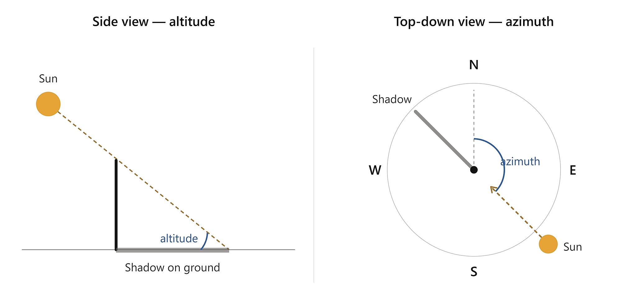
Every sun position is described by two numbers:
Azimuth - The compass direction of the sun on the horizon. 0° = north, 90° = east, 180° = south, 270° = west. Shadows fall in the opposite direction of the sun, so if the sun's azimuth is 90° (east), shadows point west (270°).
Altitude - How high the sun is above the horizon, also known as the angle of the sun, from 0° (touching the horizon) to 90° (directly overhead). Altitude controls shadow length: low sun → long shadow, high sun → short shadow. The geometry is as follows. Shadow length = object height ÷ tan. (Tan is short for tangent or angle of the sun).
So from a photo you can extract two measurements. The shadow direction gives you the azimuth and the shadow length relative to object height gives you the altitude - and you can find the time of day when SunCalc's prediction matches both.
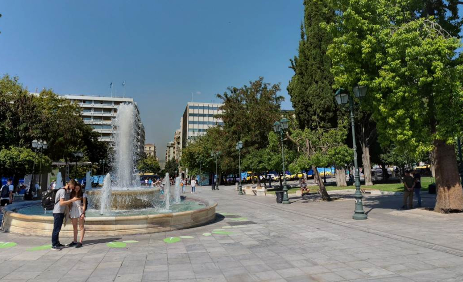
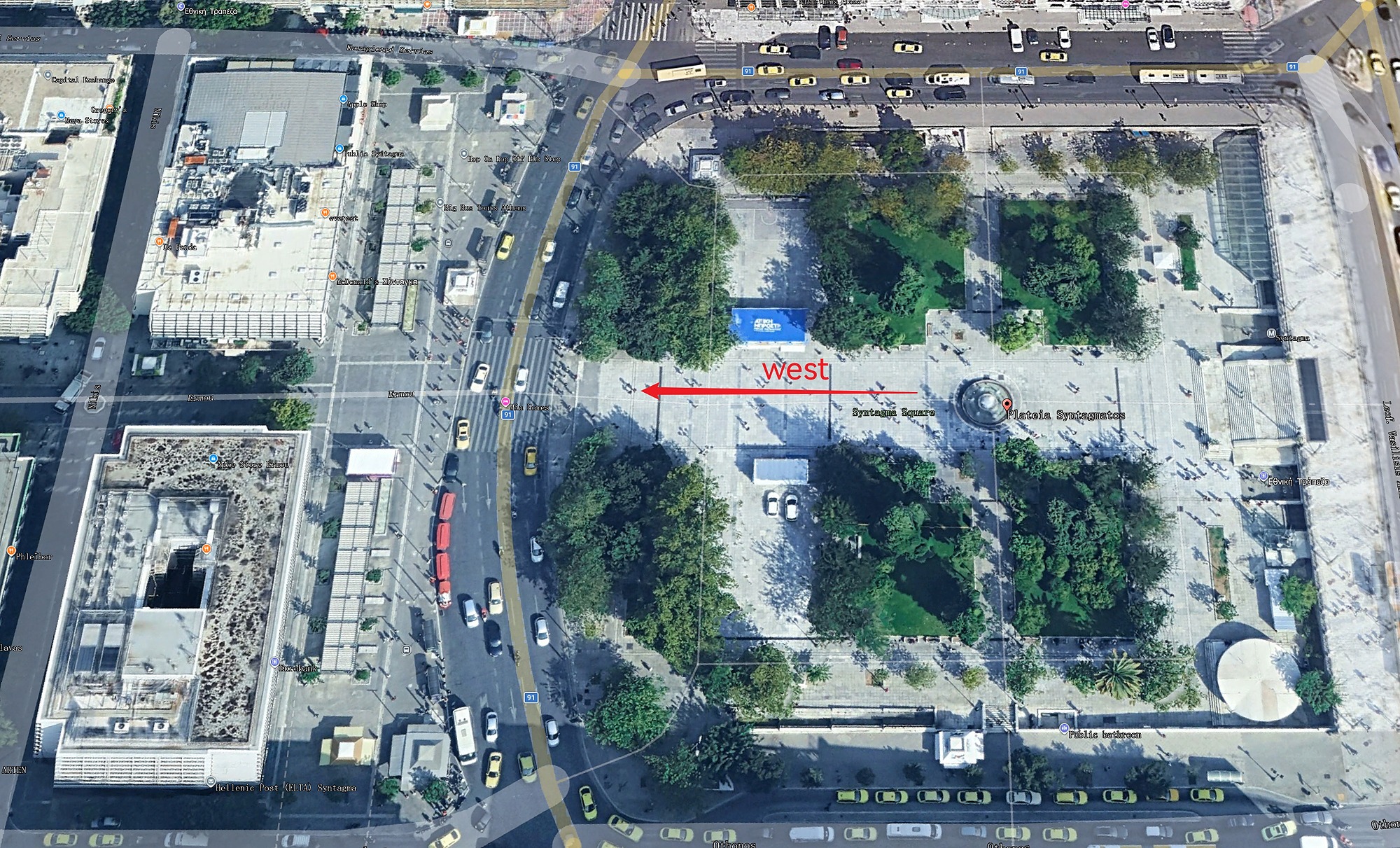
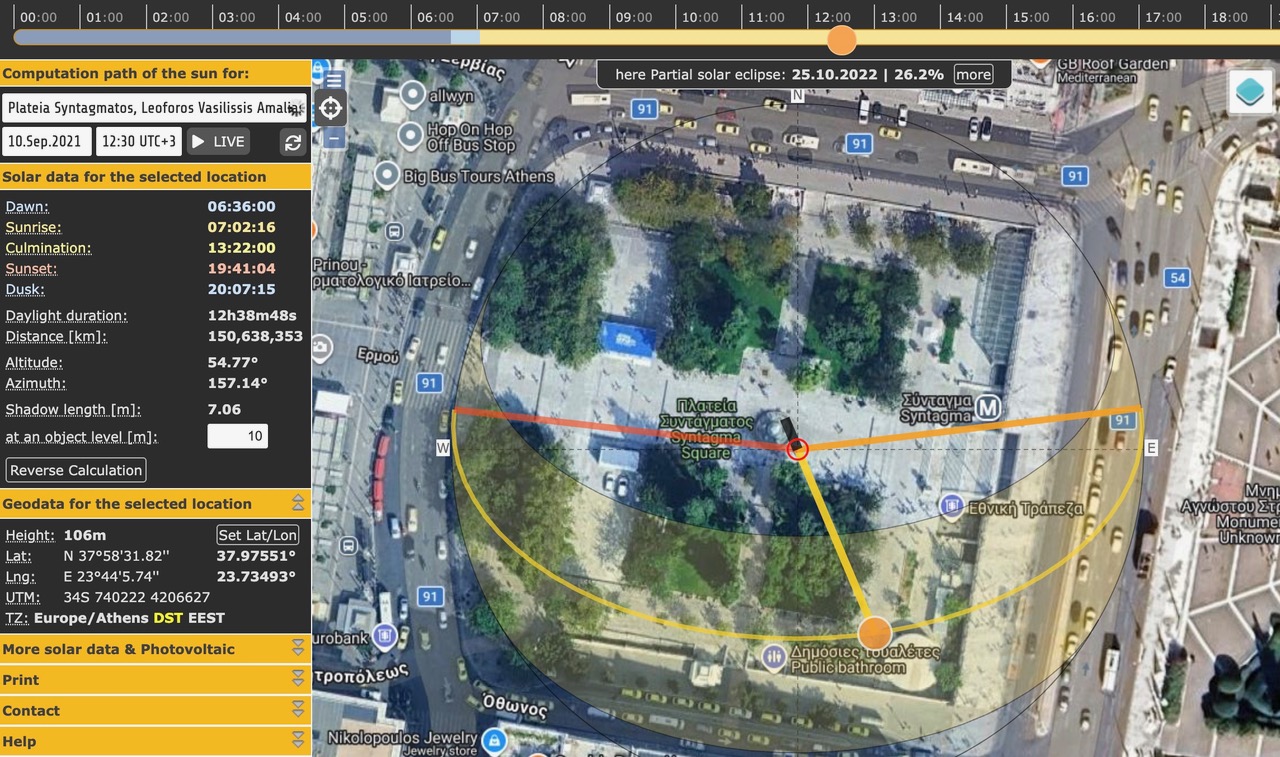
Let's look at the following photograph taken at Syntagma Square, Athens, Greece, on September 10, 2021 (below left). Chronolocation can identify the time of day by noting the angle of the couple's shadow and the direction of the camera (as revealed on Google Earth, below right) and then replicating their shadow on SunCalc.
The workflow
1. Geolocate first. This technique cannot work without latitude/longitude. Find the spot on the map using whatever clues you have - landmarks, architecture, vegetation, satellite imagery.
2. Find a date. Sun paths shift dramatically across the year, so this can't be skipped.
3. Pick a shadow-casting object. Best candidates: something standing perpendicular to flat ground with a clean, fully visible shadow. A lamp post, a fence post, a person standing upright, a building corner. Avoid sloped ground.
4. Read the shadow direction like a compass. Open Google Earth or Google Maps for the location, orient yourself with landmarks, and figure out which way the shadow is pointing in degrees. If the shadow points toward a building you can identify on satellite, draw a line on the map and measure its bearing - that's your shadow azimuth. Sun azimuth = shadow azimuth + 180°.
5. Measure the shadow-to-object ratio. Estimate the object's height versus its shadow length using anything else in the frame for scale. A 1.7m person with an 0.85m shadow → ratio 2:1 → altitude = arctan(2) ≈ 63°. A 1.7m person with a 5m shadow → arctan(0.34) ≈ 19°.
6. Open SunCalc. Drop the pin at the geolocated spot, set the date, then scrub the time. The page shows live azimuth and altitude readouts. Find the time when both match your measurements - that's the answer.