3. Mapping the World
Geospatial services play an important role in open source reporting. At their core, they provide access to satellite imagery and mapping platforms enabling journalists to identify, visualize and verify locations. The verification process is called geolocation (see Chapter 4 for a how-to guide).
Geolocation helps reveal "where" and "when" an incident happened, so journalists can assess "how" it unfolded and "why" it matters. This can provide crucial context to information, from weather events and natural disasters to international war crimes and human rights abuses.
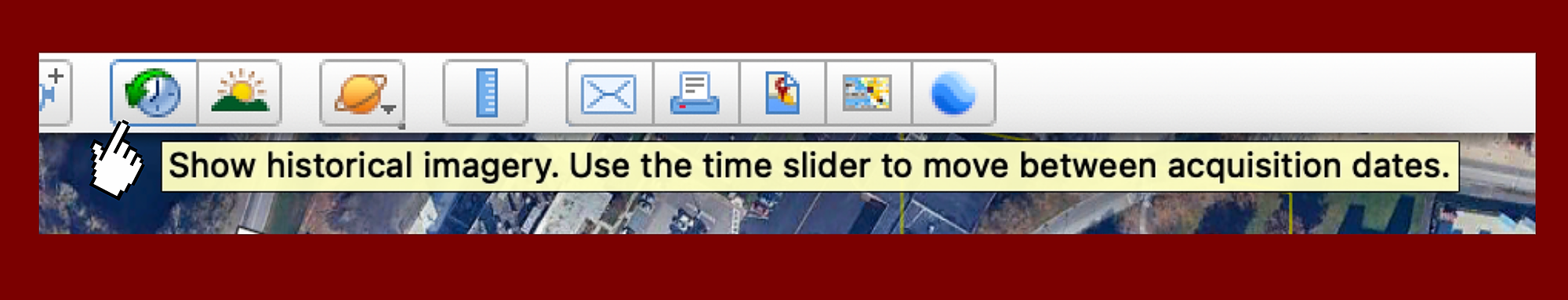
Platforms such as Google Maps and Google Earth allow for the examination of aerial and street views. These can be compared to images from the past by clicking on Google Earth's clock icon at the top of the toolbar to access its "historical imagery" slider.
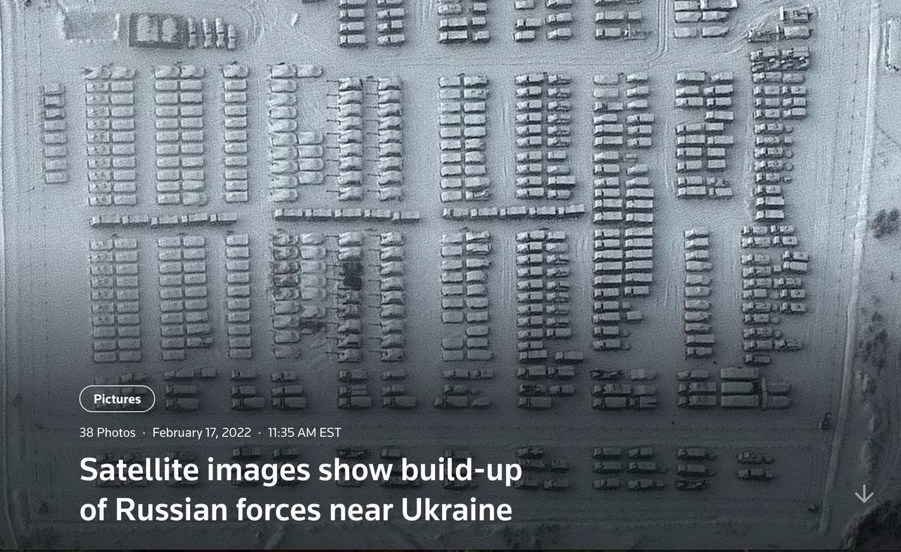
The Russian invasion of Ukraine in February 2022 was revealed to be imminent when satellite pictures showed thousands of Russian troops, tanks and armored vehicles massing in the snow near the border.
"Open source resources can be useful in verifying newsworthy events before they actually take place"
Samuel Oakford, Senior reporter, Visual forensics, Washington Post
Geolocating photos and video footage can help confirm disputed facts on the ground. Rhona Tarrant explained in her Distinguished Marie Colvin Lecture how social media images of a maternity hospital in Mariupol bombed by Russian forces in 2022 were verified using Google Maps.
"Google Maps is one of our most useful tools in open-source journalism… You can type in 'hospital,' and it will actually bring up all of the hospitals in the area. So then I go into the satellite imagery, zoom in, and start looking for something that might look like it"
Rhona Tarrant, Executive Editor, CBS News Confirmed
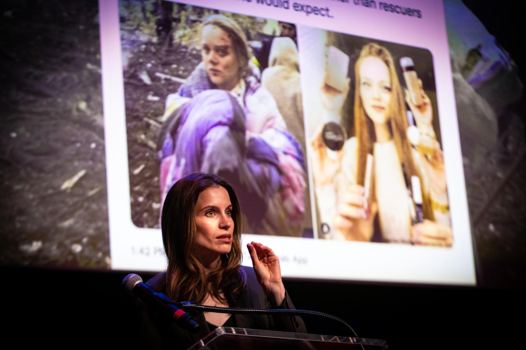
Once the location of the hospital was verified, news organizations were able to counter Russian disinformation that the bombing was a false flag operation staged by Ukraine. Facial recognition tools (see Chapter 5) were used to show that an injured pregnant woman was not an actress and beauty blogger, as Russia claimed.
Commercial providers of high-resolution satellite imagery also exist, such as Planet Labs and Vantor (formerly Maxar), though they are not free. At the U.S. administration's request, both companies agreed several weeks into the Iran war to cease broadcasting satellite images of the conflict zone, but journalists turned to other sources, such as the European Space Agency's Copernicus Sentinel-2 program (free), which they also used to double-check Iranian satellite imagery.
The PeakVisor app is helpful for mountain identification. Geohints is a useful guide for identifying features like traffic and road signs in international countries or U.S. states. And NASA FIRMS, which maps global fires, is a great resource for charting wildfires and, at times, warzone terrain.
By comparing historical and contemporary imagery, investigators can detect changes over time, such as construction (the building of a nuclear site), damage from natural disasters (forest fires), detention camps or military activity (bombing of civilian or military sites).
Alison Killing delivers a TED talk on Buzzfeed's investigation into Chinese detention camps
In 2021 Buzzfeed News won a Pulitzer Prize for its innovative investigation into China's mass detention of Uigher Muslims in the Xinjiang region. The series combined geospacial services and 3-D architectural modeling with eye-witness reports. By cross-referencing blanked-out areas on Baidu Maps (the Chinese equivalent of Google Maps) with other data, BuzzFeed was able to identify 268 new compounds built since 2017.
Whether identifying subtle environmental changes, verifying the authenticity of visual media or narrowing down precise locations, geospacial analysis relies not only on new technology but attention to detail and relentless tenacity.